White Rock, British Columbia
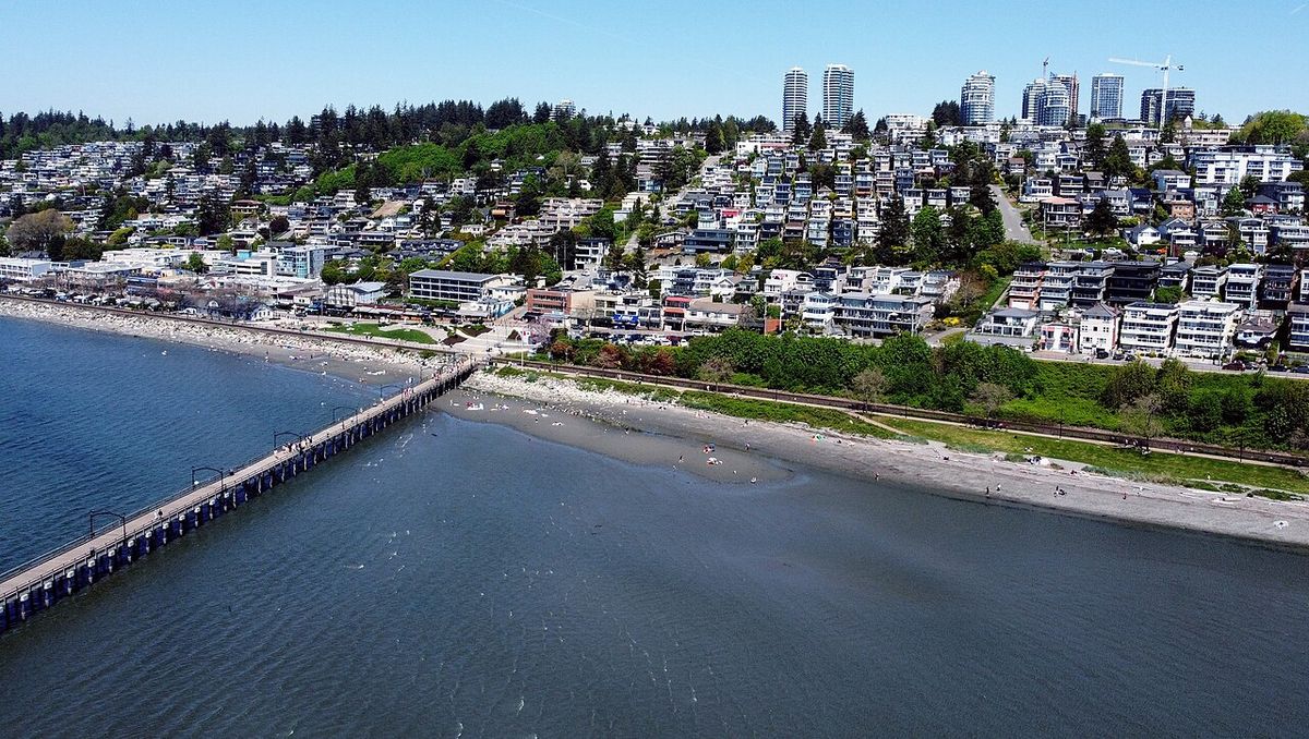
White Rock is a coastal city in the Metro Vancouver Regional District of British Columbia, Canada. It is named for a large, white-painted glacial erratic boulder on its beach, a historic navigational marker for mariners. Bordered by Semiahmoo Bay to the south and nearly encircled by the City of Surrey, White Rock is recognized for its moderate climate, scenic waterfront promenade, and lengthy pier. The city functions as a residential community and tourist destination within the Lower Mainland, distinguished by its seaside character and significant historical ties to the railway and the Semiahmoo First Nation.
Early history and Indigenous presence
The traditional territory of the Straits Salish people encompassed the region from Boundary Bay to Birch Bay in what is now the United States. The Semiahmoo First Nation maintained permanent encampments along the White Rock waterfront from at least the time of first European contact in 1791 through the 1850s. These communities constructed forts in areas like Ocean Park as lookouts against raids from northern First Nations. The international border was formalized by the Oregon Treaty of 1846, which established the 49th parallel as the boundary, a line that runs through Semiahmoo and Boundary Bays. The International Boundary Survey Commission began its work in 1857, with a camp established at the estuary of the Campbell River.
The Semiahmoo Trail, an important historical path, runs from the site of that Boundary Commission Camp overland to Mud Bay north of Crescent Beach. An 1865 survey map labels this route the 'Telegraph Trail'. During the real estate boom of the 1980s and 1990s, the City of Surrey preserved and extended the trail from 20 Avenue to the Nicomekl River. A specially constructed pedestrian overpass on 148 Street maintains the trail's continuity. This trail remains a tangible link to the pre-colonial and early colonial history of the Semiahmoo Peninsula.
Modern development and incorporation
The modern settlement of White Rock is directly tied to the construction of the Great Northern Railway line along the shore of Semiahmoo Bay in the early 1900s, which opened the area to tourists from Vancouver and New Westminster. The Peace Arch border crossing officially opened in 1908, with the Peace Arch monument constructed in the 1920s. Key infrastructure developments followed, including the opening of the present railway station in 1913, the concurrent start of the Fox and Hunter Shingle mill, and the opening of the Campbell River Mill to the east. The White Rock Pier was completed in 1914 to serve as a deep-water mooring facility. By the 1950s, residents felt underserved by the District of Surrey, where development was focused on North Surrey and Cloverdale, leading to a movement for autonomy.
The City of White Rock was incorporated by a special warrant from the provincial government on April 15, 1957. That same decade, Peace Arch Hospital opened, becoming a major employer and regional health facility. Development was initially concentrated near the waterfront, with affordable cliffside dwellings contributing to its reputation as a retirement centre, bolstered by the area's low rainfall and mild ocean-influenced temperatures. The completion of Highway 99 and the George Massey Tunnel spurred a second boom, facilitating commuting and enabling development to expand up the hillside. From the 1970s onward, the White Rock and South Surrey area transformed into a suburban bedroom community, a process that intensified with a major real estate boom in the mid-1990s that attracted young families and professionals.
- 1908: Peace Arch border crossing officially opens.
- 1913 to 1914: Railway station opens. Pier is constructed.
- 1957: City of White Rock incorporates on April 15.
- 1979: First annual international sandcastle competition begins.
- 1980s-1990s: Surrey designates South Surrey a town centre. Semiahmoo Mall opens.
- 2007: White Rock Little League team plays in the Little League World Series.
- 2018: Pier damaged in December windstorm.
- 2019: Rebuilt pier reopens August 28 at a cost of $16.2 million.
Geography, boundaries and climate
White Rock occupies a compact area of 5.17 square kilometres, with its municipal boundaries precisely defined by surrounding roads. Bergstrom Road (136 Street) forms the western limit, North Bluff Road (16th Avenue) the northern limit, Stayte Road (160 Street) the eastern limit, and 8th Avenue the southern limit. The land south of 8th Avenue from Stayte Road westward to the waterfront is the Semiahmoo Indian Reserve, which is within the jurisdictional bounds of Surrey but governed separately. The Surrey neighbourhoods of Ocean Park and Crescent Beach lie immediately to the northwest of the city. The city's geography is dominated by its waterfront along Semiahmoo Bay, featuring a long, sandy beach exposed at low tide, a promenade, and the active BNSF Railway line.
The city's climate is moderate and maritime, benefiting from a rain shadow effect because it is set away from the Coast Mountains. This results in less fog, fewer rainy days, and shorter snowfalls compared to Vancouver. Meteorological statistics confirm White Rock receives approximately 20 percent more sunshine than Vancouver. Summer average daily high temperatures are around 23 degrees Celsius, with winter averages around 6 degrees Celsius. The record high temperature of 38.5 degrees Celsius was recorded on June 28, 2021, which also saw the record high daily minimum of 20.9 degrees Celsius. The warmest month on record was August 2022, with an average mean temperature of 19.3 degrees Celsius. Annual rainfall averages 1,105 millimetres, the lowest in the Metro Vancouver region.
Demographic profile
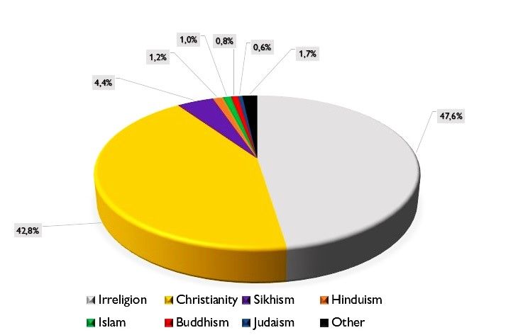
According to the 2021 Canadian census conducted by Statistics Canada, White Rock had a population of 21,939 living in 10,735 of its 11,541 total private dwellings. This represents a population increase of 10 percent from the 2016 count of 19,952. With a land area of 5.17 square kilometres, the population density in 2021 was 4,243.5 persons per square kilometre, one of the highest densities in the region. The religious composition of the city, as reported in the 2021 census, demonstrates significant diversity. A plurality of residents, 9,855 persons or 47.6 percent, reported no religious affiliation. Christianity was the largest reported religion, with 8,875 adherents comprising 42.8 percent of the population.
| Religious Group | Number of Persons | Percentage of Population |
|---|---|---|
| No religion | 9,855 | 47.6% |
| Christianity | 8,875 | 42.8% |
| Sikhism | 905 | 4.4% |
| Hinduism | 245 | 1.2% |
| Islam | 205 | 1.0% |
| Buddhism | 160 | 0.8% |
| Judaism | 115 | 0.6% |
| Other | 360 | 1.7% |
Landmarks, events and cultural life
The city's namesake is a 486-ton granite glacial erratic located on the beach. Historically, the boulder was covered in white guano from shellfish-eating seabirds, which led 19th-century sailors to use it as a navigational marker. The city parks department now maintains its white colour through monthly applications of paint, and it has been a frequent target for graffiti. The adjacent White Rock Pier, rebuilt and reopened in 2019 after storm damage, is a central community gathering place. The annual Spirit of the Sea Festival, held on the first weekend of August since 1949, is a major event featuring a parade, fireworks, music stages, and a sandcastle competition. The city also hosts the Tour de White Rock bicycle road race every July, which attracted over 150 riders and was part of the Canadian Cycling Association's national Road Race Series in 2005.
The community has a strong tradition of sandcastle competitions. The original internationally famous event was organized in 1979 by chartered accountant Tom Kirstein and architect Chip Barrett, taking advantage of the long, sandy beach at low tide. At its height, it awarded prizes up to $10,000 and drew crowds estimated at 150,000 before ending in 1987 due to security costs. A revival was launched in 2008 by a group of local high school students and community members, drawing 40,000 guests and over 70 teams. White Rock has also served as a filming location for numerous productions, including the 1965 film The Railrodder with Buster Keaton, the 1982 movie Big Meat Eater, and television series such as Psych, The X-Files, and an episode of Better Things titled 'White Rock'. The local Ocean Rock Cafe on Marine Drive and the pier were featured in K-pop group Twice's 2018 music video for 'Likey'.
Transportation and economic infrastructure
Transportation in White Rock is predominantly road-based, with Highway 99 serving as the primary freeway link to Vancouver to the north and to U.S. Interstate 5 via the Peace Arch border crossing to the south. King George Highway (Highway 99A) connects the border with Surrey Central station and New Westminster. Johnston Road (152 Street) provides a link to Guildford and the Trans-Canada Highway (Highway 1). Public transit is coordinated through the White Rock Centre transit exchange. Key bus routes include the 351 and 354, which run to Bridgeport station in Richmond, requiring a transfer to the Canada Line for Vancouver. The 352 express bus serves Ocean Park and South Surrey Athletic Park directly. Routes 321, 345, and 394 provide service to North Surrey and SkyTrain stations, while the 375 runs from near the Peace Arch border to Guildford Town Centre. Community Shuttle routes 360, 361, 362, and 363 service local White Rock and South Surrey communities.
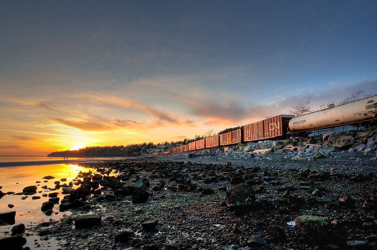
The BNSF Railway owns a single-track main line that runs the length of the White Rock beach promenade. This line is a major freight corridor for goods transported between the Port of Vancouver and the continental United States, carrying Canadian softwood lumber, coal, paper products, and general merchandise. The Canadian National Railway and Canadian Pacific Railway have trackage rights on the line, with CP running regular potash trains to the Canpotex export terminal in Oregon. The rail corridor also supports the Amtrak Cascades passenger service between Seattle and Vancouver via Bellingham, Washington. While the city itself has no passenger train service, the railway's presence is a defining element of the waterfront and a reminder of the settlement's origins.
Notable residents
White Rock has been home to a wide array of notable individuals across sports, entertainment, arts, and public service. In sports, the city has produced National Hockey League players such as goaltender Andrew Hammond of the Colorado Avalanche, defenseman Jason Garrison, and former Columbus Blue Jackets left winger Colton Gillies. Olympic athletes from White Rock include swimmer Hilary Caldwell and weightlifter Christine Girard. Professional skateboarder Andy Anderson and football players Riall and Teyo Johnson also hail from the area. In entertainment, actors with ties to White Rock include Cobie Smulders, known for How I Met Your Mother. Jewel Staite from Firefly. Gabrielle Miller. Hannah Simone of New Girl. And Paul Campbell from Battlestar Galactica. Filmmaker Gigi Saul Guerrero and singer Desirée Dawson, winner of the 2016 Searchlight contest, are also residents.
The arts community includes singer and Trooper founder Ra McGuire, rock-reggae musician Daniel Wesley, wood sculptor Arnold Mikelson, artist Gordon Rice, and sportscaster Jim Hughson. In public life, Gordon Hogg served as the BC Liberal MLA for Surrey-White Rock from 1997 to 2017 and later as the Liberal Party of Canada MP for South Surrey-White Rock from 2017 to 2019. Ernie Klassen has served as the Liberal MP for South Surrey, White Rock since 2025. Other notable figures include supercentenarian and last surviving Boer War veteran George Frederick Ives, Hockey Hall of Fame member Moose Johnson, and Football Canada President and broadcaster Jim Mullin.
- Hilary Caldwell: Olympic bronze medalist swimmer.
- Christine Girard: Olympic gold medalist weightlifter.
- Ra McGuire: Singer and founder of the rock band Trooper.
- Gordon Hogg: Former MLA and MP for the region.
- Jim Hughson: Renowned hockey play-by-play announcer.
- Cobie Smulders: Actress known for her role in How I Met Your Mother.
Questions about White Rock, British Columbia
What is the White Rock and why is it painted?
The White Rock is a 486-ton granite glacial erratic located on the city's beach. Historically, it was naturally whitened by guano from seabirds, making it a recognizable feature for sailors. To maintain this distinctive white colour, the city parks department applies white paint to the boulder on a monthly basis. It has also been a frequent target for graffiti over the years.
How was the White Rock Pier rebuilt after the 2018 storm?
The White Rock Pier was severely damaged on December 20, 2018, during a windstorm when sailboats broke free and destroyed a 30 metre section. Initial replacement plans estimated a cost of over 5 million dollars. However, the final cost to rebuild the pier to modern seismic standards was 16.2 million dollars. The reconstructed pier reopened to the public on August 28, 2019, though some finishing elements like lighting were completed afterwards.
How does White Rock's weather compare to Vancouver's?
White Rock has a more moderate climate than Vancouver, receiving 20 percent more sunshine annually. It also has less rainfall, with an annual average of 1,105 millimetres. The city experiences fewer foggy days and shorter snowfalls because it is situated away from the Coast Mountains. Summer average high temperatures are around 23 degrees Celsius, and winter averages are around 6 degrees Celsius.
What major community festivals are held in White Rock?
The major community festival is the Spirit of the Sea Festival, held every first weekend of August since 1949. It features a parade, fireworks, and a sandcastle competition. Another key event is the Tour de White Rock bicycle race in July, which attracts over 150 riders. The community also revived a large sandcastle competition in 2008, which drew 40,000 spectators and over 70 teams.
What are the population trends in White Rock?
White Rock's population was 21,939 according to the 2021 Canadian census, which represents a 10 percent increase from its 2016 population of 19,952. With a land area of 5.17 square kilometres, this results in a very high population density of 4,243.5 persons per square kilometre. This growth is part of the city's development pattern, which intensified as a suburban bedroom community from the 1970s onward. A real estate boom in the 1980s and 1990s drew many young families to the area. The city's moderate climate and coastal setting have also contributed to its appeal as a residential community within the Metro Vancouver Regional District.
What public transit options connect White Rock to Vancouver?
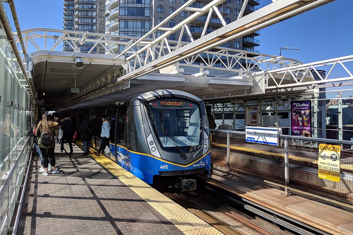
Public transit from White Rock to Vancouver primarily involves bus routes that connect to the SkyTrain rapid transit system. Most routes run through the White Rock Centre transit exchange. From there, the 351 and 354 buses travel to Bridgeport Station in Richmond, where passengers must transfer to the Canada Line to reach downtown Vancouver. Alternatively, routes such as the 321, 345, and 394 provide service to Surrey Central and King George SkyTrain stations, connecting to the Expo Line. The city itself has no train service, though the BNSF Railway line along the beach is a major freight corridor and is used by the Amtrak Cascades passenger service between Seattle and Vancouver.
Sources and further reading
- White Rock, British Columbia (Wikipedia)
- Explore White Rock | Unique & Local Experiences are Found ... (explorewhiterock.com)
- White Rock | Vancouver and Area (travel-british-columbia.com)
Checked by the Your Space Hamilton desk. Last updated 2026-10-31.