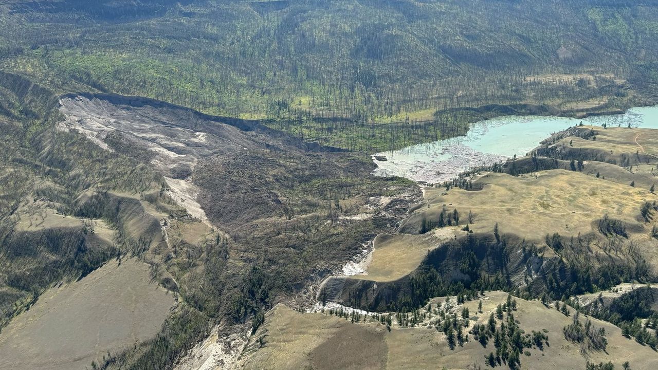
Massive Northwest Territories landslides moved millions of cubic metres in days
New research describes how wildfires and thawing permafrost triggered two enormous landslides in the Mackenzie River basin.
YELLOWKNIFE — Two enormous landslides in the Northwest Territories moved millions of cubic metres of earth in a matter of days, triggered by wildfires and a distinct type of permafrost failure, according to new research.
The landslides occurred on the Johnson River in August 2017 and the Redstone River in August 2018.
Researchers call them "permafrost detachment slides," a process where the frozen ground fails about 20 metres down, causing a rapid collapse from the bottom up.
READ MORE: Scientists discover hidden drainage system at the back of the eye
READ MORE: Los Angeles wildfires show growing health threat of wildfire smoke
"They can move the amount of material, which would take standard ways of permafrost failure a few decades to reach, in a matter of days in some cases," said Joseph Young, lead author of the study published last month in Geophysical Research Letters.
Young, who worked on the research as a PhD student at the University of Alberta, said typical permafrost thaw causes landslides over decades as warming air and precipitation thaw the ground from the top down.
The Redstone River slide moved about 4.5 million cubic metres of ground into the river basin.
The Johnson River slide, which showed signs of failure for some time before it happened, moved about 18 million cubic metres of earth, enough to fill about 7,200 Olympic swimming pools.
Eric McLeod saw the Johnson River slide from the air and watched the landscape change in subsequent years. He flew over the area four times a year until about 2021.
In May 2017, he saw a huge portion of land had already slid into the river.
"The helicopter pilot had noticed that he had seen it before, and he had said it is now completely all the way down the hill and blocked the river, and it’s creating a lake," McLeod said.
He described the land as looking like it "got stretch marks." After landing at the site later that year, he compared some displaced earth pieces to the size of houses.
Young said severe wildfires in the area in 1995 set off the process that led to the slides.
Co-author Steve Kokelj, with the Northwest Territories Geological Survey, said the fires wiped out organic material, immediately impacting the top layer of permafrost.
"About 15 to 20 years after the fire, all of these larger disturbances start to occur within these old burn areas," Kokelj said. "That’s about the time it takes for that to permeate 20 metres into the ground."
He said the warming effect of the fire compounded with the effects of a warming climate.
For these specific slides, Young and Kokelj said there are predictive signs that appear over about 20 years after a fire, including a slow downslope movement of the slopes.
"That’s kind of the silver lining," Young said. "It doesn’t just happen overnight."
With files from CBC News