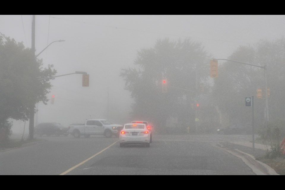
Fog blankets Thunder Bay to start weekend before clearing to cloudy skies
The fog is expected to dissipate Saturday morning, leading to a mainly cloudy day with a high of 18 C and a chance of showers Sunday.
THUNDER BAY — Thunder Bay started Saturday under a blanket of fog, with drivers advised to use caution as visibility varied near low-lying areas and waterways.
The fog patches were expected to dissipate through the morning, leading to a mainly cloudy day with a high of 18 C, according to Environment and Climate Change Canada's forecast.
No weather warnings, watches or advisories were in effect for the city as of 6:17 a.m. EDT Saturday.
READ MORE: Thunder Bay faces windy Sunday before sun returns and temperatures rise
READ MORE: Airdrie faces first snowfall of season as temperatures plunge for Thanksgiving weekend
"Fog is the main early travel concern," the forecast stated, advising drivers to use low-beam headlights, slow down and leave more room between vehicles.
Visibility can change quickly over short distances, even when nearby roads appear clear.
Fog patches are forecast to develop again after midnight Saturday, with a low of 9 C, and could affect rural roads, Highway 11/17 approaches, bridges and areas near rivers and Lake Superior early Sunday.
Sunday will be "cloudy with a 40 per cent chance of showers" and a high of 17 C, with cloudy conditions and a 40 per cent chance of showers continuing Sunday night and a low of 8 C.
Monday is expected to be "sunny with a high of 18 C." Clouds will return Monday night, bringing a 30 per cent chance of showers and a low of 10 C.
The Air Quality Health Index for Thunder Bay was listed as 1, or low risk, in the 6:00 a.m. provincial summary, with a forecast maximum of 2 for Saturday, Saturday night, Sunday and Sunday night.
"At these levels, most people can continue their usual outdoor activities. People with heart or breathing conditions should still follow their regular health plan and watch for symptoms," the forecast said.
On Western Lake Superior, a quiet marine pattern is in place with no watch or warning in effect from the forecast issued at 3:00 a.m. EDT Saturday.
Winds are forecast at 10 knots or less through Sunday, with offshore waves remaining at 0.5 metres or less.
The open-lake marine bulletin does not identify precipitation, thunderstorms, fog or another specific visibility restriction for the forecast period, but noted fog in the city forecast may affect the harbour, shoreline and some nearshore waters Saturday morning and again late Saturday night.
The forecast described conditions as generally favourable for many powered recreational boats, as winds of 10 knots and waves no higher than 0.5 metres are below strong-wind-warning levels.
"That does not make every trip risk-free," it stated, adding that "small boats, canoes, kayaks and paddleboards remain more exposed to cold water, changing visibility and local chop."
"Conditions at a sheltered marina should not be used as the only guide for a trip beyond the harbour."
An extended wind outlook calls for light winds Monday. On Tuesday, light winds will become southeast at 15 knots. South winds at 20 knots are forecast Wednesday before diminishing to light late in the day.
The UV index for Saturday is 4, or moderate.
With files from NetNewsLedger